
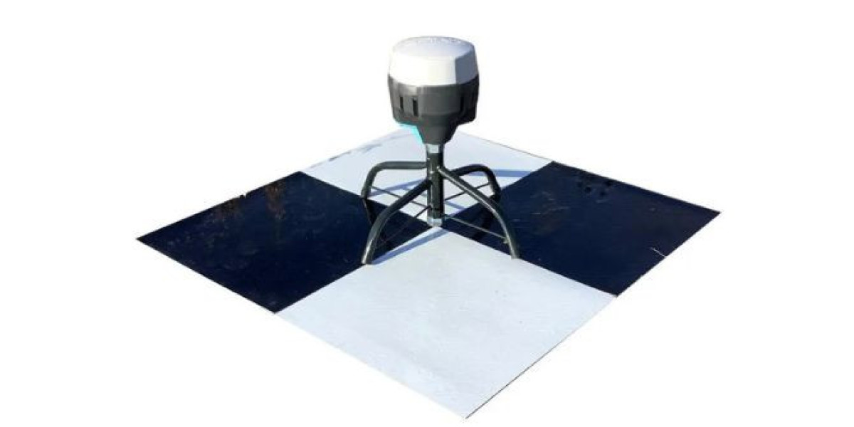
Accurate aerial mapping depends on more than just advanced drones and high-resolution cameras. Even with modern RTK and PPK systems, small positioning errors can still affect final outputs. This is why professionals rely on drone GCP targets to improve mapping precision.
These ground reference markers help connect aerial imagery with real-world coordinates, ensuring better accuracy in orthomosaic maps, digital elevation models (DEM), and 3D reconstructions.
What Are Drone GCP Targets?
Drone GCP targets (Ground Control Point targets) are physical markers placed on the ground at known coordinates. Survey teams measure these points using GNSS receivers or total stations before flying the drone.
Once aerial data is captured, these points are used in photogrammetry software to align and correct the dataset.
Common applications include:
- Drone photogrammetry projects
- Topographic surveying
- Construction site mapping
- Mining volume calculations
- Infrastructure inspection
They act as fixed reference anchors for georeferencing aerial data.
Why Accuracy Matters in Drone Mapping
Drone mapping systems rely heavily on GPS data from onboard sensors. However, even high-end drones can experience small errors due to:
- Satellite signal drift
- Atmospheric interference
- Camera angle distortion
- Terrain elevation changes
- Flight path inconsistencies
Without correction, these errors can lead to misaligned maps and inaccurate measurements.
How Drone GCP Targets Improve Orthomosaic Accuracy
Orthomosaic maps are created by stitching thousands of aerial images into a single, georeferenced map. If alignment is incorrect, the entire map can shift or distort.
Key improvements include:
- Better image alignment across overlapping photos
- Reduced horizontal and vertical positioning errors
- Improved real-world coordinate matching
- More reliable GIS integration
When using drone GCP targets, mapping software adjusts image placement based on known ground coordinates, resulting in highly accurate orthomosaics.
Enhancing 3D Mapping and Point Cloud Accuracy
3D models and point clouds depend on precise spatial positioning. Even minor GPS errors can distort height and structure representation.
GCPs improve 3D mapping by:
- Correcting elevation (Z-axis) errors
- Improving terrain modeling accuracy
- Enhancing building and structure alignment
- Reducing drift in large-area reconstructions
This is especially important for engineering, construction, and land development projects where precise measurements are critical.
Best Practices for Using GCP Targets
Proper placement and measurement are essential for achieving accurate results.
Recommended practices:
- Distribute targets evenly across the survey area
- Place points at edges and center zones
- Avoid obstacles, shadows, and reflective surfaces
- Ensure high visibility from aerial imagery
- Use GNSS or RTK equipment for precise coordinates
- Include checkpoint markers for validation
A well-planned layout ensures balanced correction across the entire dataset.
Types of Drone GCP Targets
Different projects require different types of ground markers.
Common types include:
- Printed targets: High-contrast markers placed on flat surfaces
- Painted targets: Directly marked on ground or pavement
- 3D targets: Raised markers for better visibility in rough terrain
- Temporary targets: Used for short-term surveys
- Permanent markers: Installed for long-term monitoring projects
Each type supports different field conditions and project requirements.
Benefits of Using Drone GCP Targets
Using properly placed control points significantly improves mapping outcomes.
Key benefits:
- Higher mapping accuracy
- Reduced georeferencing errors
- Improved data reliability
- Better quality assurance and validation
- Enhanced compatibility with GIS systems
- Increased confidence in measurement outputs
These advantages make GCPs essential for professional surveying workflows.
GCPs vs RTK/PPK Drones
Modern drones with RTK or PPK systems reduce dependency on ground control, but they do not fully replace it.
Comparison:
- RTK/PPK drones: Improve onboard GPS accuracy
- Drone GCP targets: Provide ground truth verification
In most professional workflows, both are used together for maximum accuracy.
Conclusion
High-quality drone mapping depends on more than just advanced hardware. It requires accurate spatial correction and validation. Drone GCP targets play a critical role in improving orthomosaic alignment and 3D model precision.
By reducing positioning errors and providing real-world reference points, they ensure that aerial data is reliable, measurable, and ready for professional use in engineering, construction, and surveying projects.